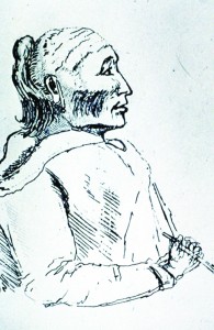
Lake Wabakayne, located just north of Britannia Road and Erin Mills Parkway, is named for Chief Wabukanyne, one of the principal chiefs of the Native Mississaugas from the Eagle Clan at the Credit River. He was one of the signees of the “First Puchase”, Treaty 13-A, in 1805. His name is translated to mean “White Snow”.
The Lake Wabukayne that we know today is a man-made lake that was originally part of the farm of Henry Cooke who settled on Lot 6 in 1829. Wabukayne Creek that ran through the farm was dammed in the 1940’s by Cecil Cook to create a cattle pond.
Remnants from the farm, including tree lines, wells, apple orchards, etc., can still be found in the park.
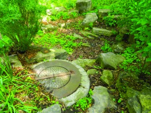
This well is the former farm well from the Cook(e) farm, which supplied the barn. The well likely dates to the late 1800s/early 1900s. The well was adjacent to the original course of Wabukayne Creek.
In the 1970’s the existing storm water pond was built to serve the new community of Meadowvale. Over the past 40 years, the lake has grown into a naturalized area and is home to many species of birds and wildlife. Part of the Wabukayne park trail, there is a walking path that circles the lake and is a great place to jog or stroll in nature. The path around the lake is approximately 1/2 a kilometre so it is a good walk for people of all ages. Many people enjoy walking and bench sitting there in the nice weather, so they can see the ducks and other animals.